
Ongoing Projects
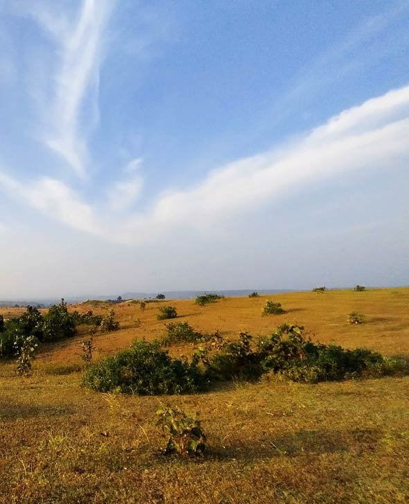
Recent decadal-scale changes in land use/land cover in the Terai-Duar Savanna and Grasslands Ecoregion: Implications for terrestrial carbon cycling and plant biodiversity
Across the world, land use and land cover (LULC) have changed greatly in the last 300 years. Today, more than 75% of the ice-free land surface stands modified to varying extents by anthropogenic impacts. The most prominent change has been the rapid decrease in forest land area and the corresponding rapid increase in cropland area. Such a rapid transformation of land, in particular of vegetation and soils, is expected to have wide-ranging impacts , including significant changes to the terrestrial carbon cycle, biodiversity loss of most taxa, and the decline of ecosystem services. Increased energy and nutrient inputs to agricultural systems raise agricultural production and support expansion in human settlement, further increasing the demand for natural resources. Documentation of such changes at regional and continental scales over centuries or even decadal scales is clearly difficult due to the paucity of detailed historical records. However, there is little doubt that drastic changes in land use and land cover (LULC) have occurred in most regions of the world, with impacts on terrestrial carbon cycling, biodiversity, and ecosystem services at all scales.
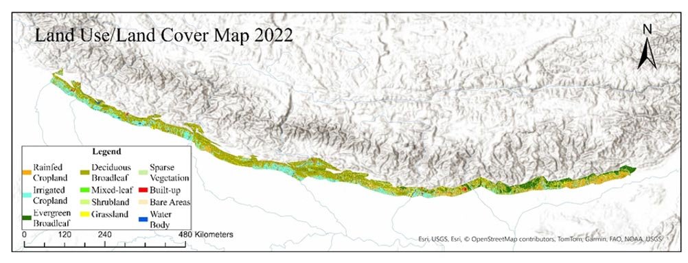
Here we focus on a unique ecoregion in the Indian subcontinent, called the Terai-Duar Savanna and Grasslands ecoregion (henceforth TDSG), which is one of 867 ecoregions identified in a global assessment, based on biogeographic realms and regional differences in flora and fauna. The TDSG ecoregion occurs as a narrow belt (~25 km North-South width) across almost the entire East-West range at the base of the Himalayas (Fig. 1).
The region hosts high biodiversity and endemism across several taxa but has also seen extensive expansion of human populations in recent decades. Natural ecosystems in this ecoregion, consisting of complex vegetation mosaics of forests, savanna, and pure grasslands, host a high diversity of plants, birds, and mammal species, among others. However, most of the areas have been transformed into agricultural lands and other human-dominated land uses, leaving very few intact habitats (~20% of land area) for the numerous endemic and habitat specialist species of flora and fauna (Fig. 1). Even the protected areas in the TDSG are not immune to disturbance or extrinsic factors causing changes to vegetation. The impacts of climatic changes in the TDSG ecoregion are less well known but is likely reminiscent of the situation across the world where the more immediate and important cause of species and habitat loss is the destruction, degradation, and overexploitation of natural resources rather than climate change. The TDSG ecoregion appears to be greatly affected by recent changes to land use and land cover, but it is unclear what fraction of the TDSG land area still hosts natural ecosystems, how fragmented and isolated the patches of natural vegetation are, and how these drastic changes to LULC have impacted terrestrial carbon cycling and biodiversity patterns.
In our project we have set three broad goals, but we are also more expansive about exploring other dimensions.
- To quantify the extent of transformations of natural vegetation and other natural land formations to agricultural and other human-dominated lands.
- To quantify the concomitant changes to terrestrial carbon cycling (aboveground and belowground pools) associated with the LULC changes.
- To assess the impacts of the observed LULC changes on plant diversity and vegetation structure (grassland-woodland mixtures) in this ecoregion
For this region we are documented land use/cover changes that have taken place in the last few decades focusing mainly on the loss the grassland habitats, increase in deciduous forest sites, increase in agricultural land and built-up areas. Next, we examine the consequences of these changes for plant diversity, ecosystem services, aboveground and belowground biomass pools, soil carbon fractions, and even ant diversity and ant-mediated soil engineering effects.

